how to read a map
Introduction to Map Reading
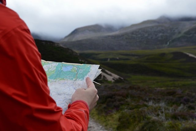
Map reading is an essential skill that enables individuals to navigate through various environments, whether in the wilderness or urban settings. Understanding how to read a map not only enhances one’s ability to explore but also fosters a greater appreciation for geography and spatial awareness.
Maps serve as crucial tools, providing visual representations of terrains, structures, and features of a given area. They can be integral for outdoor activities such as hiking, camping, or orienteering, where knowledge of the landscape is vital. Navigators rely on maps to discern trails, elevation changes, water sources, and other geographical landmarks. Furthermore, in urban navigation, maps assist individuals in finding routes, accessing transit options, and comprehending the layout of cities, leading to more efficient travel.
Beyond simple navigation, effective map reading skills enable an individual to interpret various types of maps, including topographic, road, and thematic maps. Each map type serves a distinct purpose and requires unique skills to understand its symbols and signals. For instance, topographic maps are detailed and indicate elevation and landscape contours, while road maps focus on transportation routes and city layouts. Mastering the ability to read these maps is invaluable for both leisure and practical everyday use.
In today’s digital age, while GPS technology has revolutionized navigation, a solid understanding of how to read a map remains critically important. Situations may arise where technology fails, and having the knowledge to interpret a physical map can significantly enhance one’s ability to navigate effectively. This guide will delve into the various skills and techniques essential for proficient map reading, preparing readers for both urban and outdoor exploration.
Understanding Map Scales
Maps serve as invaluable tools for navigation and exploration, and a critical aspect of their functionality is the map scale. The map scale is a ratio that expresses the relationship between distances on the map and actual distances on the ground. To utilize a map effectively, it is essential to understand how to read a map scale, as it dictates how far apart locations are in real life. Typically, this scale is presented in one of three formats: a graphic scale, a verbal scale, or a fractional scale. Each format has its unique utility depending on the user’s requirements.
The graphic scale, often resembling a ruler, provides a visual guide that allows users to measure distances directly on the map. A verbal scale, on the other hand, expresses the ratio in words, such as “1 inch equals 1 mile,” making it straightforward to comprehend. Finally, a fractional scale is represented as a ratio, such as 1:100,000, indicating that one unit on the map equals 100,000 of the same units in reality. Understanding these variations is crucial for accurately interpreting the information presented on a map.
To measure distances between two points, one must be adept at converting the map measurements into actual ground distances using the indicated scale. For example, if a user measures a distance of two inches on the map with a scale indicating that 1 inch equals 5 miles, they can deduce that the distance between those two points in reality is 10 miles. Such conversions are fundamental skills in navigation, enabling effective planning and route selection. Overall, grasping the concept of map scales plays a significant role in mastering the essential skill of how to read a map, ultimately enhancing navigation accuracy.
Decoding the Legend (Key)
Understanding a map fully depends greatly on one essential component—the map legend, also known as the key. The legend serves as a valuable guide that decodes various symbols and colors used within the map, allowing users to interpret the information accurately. A typical map features numerous symbols which denote landmarks, roads, terrains, and bodies of water, among others. Each symbol represents distinct features of the area depicted in the map.
For example, parks might be represented by a green area, while lakes and rivers are typically illustrated in blue. Roads can vary widely in color and thickness, representing different types of thoroughfares such as highways, local roads, and footpaths. When embarking on your journey into understanding how to read a map, a thorough examination of the legend should be your first step.
To effectively reference the legend, it is advisable to familiarize yourself with the symbols used before you head out. Take note of any unique markers that may denote points of interest, such as tourist attractions or historical sites, which are essential for anyone looking to explore unfamiliar regions. Furthermore, some maps may utilize shading or contour lines to indicate elevation changes; these are also key elements explained in the legend.
While using a map, regularly glance back at the legend to ensure you are interpreting the symbols correctly. This will not only enhance your overall understanding of the terrain you are navigating but will also assist you in making informed decisions regarding your route. Mastering the art of interpreting the legend effectively is a crucial skill in learning how to read a map proficiently.
Finding North: Orientation of the Map
Understanding how to read a map requires one to grasp the essential concept of map orientation, particularly the alignment with geographic directions. The first step in properly orienting a map is to identify the north indicator, commonly found in the map’s corner. This symbol will typically take the form of a small arrow or a compass rose, indicating the direction of north. When navigating, aligning your map accurately with terrain features is crucial for effective usage.
Using a compass is a standard technique for achieving this alignment. Begin by holding the compass flat in your hand and ensuring it is level. The needle will naturally orient itself towards magnetic north. To align your map, rotate it until the north on the map corresponds with the direction indicated by the compass needle. This precise method helps in accurately correlating your current position with the information displayed on the map, allowing for improved navigation.
Alternatively, if you do not have a compass available, you can also find north by observing natural landmarks or the position of the sun. In the daytime, the sun rises in the east and sets in the west, which can help you approximate north during daylight hours. For example, by standing with the sun at your back, you will be facing south, placing north to your left. By observing distinctive features in the landscape, such as mountains or rivers, you can gain a clearer sense of direction. Correctly orienting your map is fundamental when learning how to read a map, as it establishes a vital foundation for further navigation skills.
Reading Symbols and Understanding Features
Map reading involves more than just understanding direction; it includes interpreting a variety of symbols and recognizing features depicted. Each map utilizes a unique set of standardized symbols that represent real-world objects and terrains. Understanding these symbols is crucial for anyone learning how to read a map efficiently.
Topographic maps, for instance, indicate elevation and terrain features through contour lines. These lines connect points of equal elevation, allowing users to identify mountains, valleys, and plains. The closer the lines are to one another, the steeper the terrain. Additionally, flat areas or lowlands will have significant spacing between contour lines. Other symbols to note include hachures, which depict depressions and indicate changes in elevation.
Natural features such as rivers, lakes, and forests are equally vital components of map interpretation. Rivers are often represented by blue lines that can vary in width, indicating their size. Larger rivers may be depicted with wider lines, whereas smaller streams are narrower. Lakes are illustrated as shaded blue areas, and forests are usually marked by green patches or symbols resembling trees. Recognition of these natural elements is essential for navigating landscapes accurately.
Urban features such as roads, buildings, and parks also have their specific symbols. Roads are typically represented by black or gray lines, with different widths designating the type of roads; major highways are generally wider than local streets. Buildings may appear as shaded squares or rectangles, while parks are often highlighted in green with symbols indicating facilities available.
Understanding how to read a map requires familiarity with these symbols. By recognizing these representations, individuals can decode the information a map conveys and navigate with increased confidence. Practice is vital; as one frequently refers to symbols in various maps, comprehension of their meanings will become more intuitive, enhancing the overall map-reading experience.
Using Contour Lines for Terrain Analysis
Contour lines are a fundamental feature on topographic maps, serving as vital indicators of elevation and terrain shape. These lines connect points of equal elevation and help to visualize the lay of the land, making them essential for anyone learning how to read a map effectively. Understanding contour lines enables individuals to analyze the terrain, determine elevation levels, and identify the steepness of slopes.
When examining a topographic map, it is important to understand how each contour line represents a specific elevation. Generally, the space between these lines indicates the steepness of an area; closely spaced lines suggest a steep incline, while widely spaced lines indicate a gentler slope. This knowledge assists in planning outdoor activities, like hiking or mountain climbing, as it determines the difficulty of the terrain.
In addition to slope steepness, contour lines provide insights into the shape of the land. For instance, a circular arrangement of lines typically represents a hill or mountain peak, whereas V-shaped contours can indicate a valley or riverbank. By learning how to read contour lines, one can obtain a comprehensive understanding of the geographical features present in the area, enhancing navigational skills.
Moreover, contour lines can denote changes in topography, such as ridges and depressions. Recognizing these can be crucial for navigating through challenging landscapes. As you become more adept at interpreting contour lines and their implications, you will find that the ability to analyze terrain expands your outdoor navigation capabilities significantly.
In conclusion, mastering the interpretation of contour lines is a crucial skill for effective map reading. It not only improves your understanding of the landscape but also enhances safety and enjoyment during outdoor activities by allowing for better-informed decisions related to terrain navigation.
Utilizing Grid Lines for Location Identification
The grid system on maps serves as a fundamental tool for navigating and identifying specific locales. Grid lines, which form a matrix across the map, are usually expressed in a numerical format consisting of vertical and horizontal lines that intersect to create a series of squares or rectangles. Each square represents a specific area, which can be referenced by its corresponding coordinates. Understanding how to read a map effectively requires an appreciation of this grid system.
To leverage grid lines for pinpointing your location, start by identifying the grid square number corresponding to your current position. This typically involves finding the nearest labels or coordinates on the map’s edge. The horizontal numbers are usually designated as eastings, while vertical numbers are referred to as northings. For instance, if a location is marked by the coordinates 6572, this indicates that it lies within the grid square defined by the intersection of the eastings (65) and northings (72).
Moreover, familiarity with these coordinates can facilitate efficient navigation. When you are unfamiliar with your surroundings, you can locate prominent landmarks and then cross-reference their grid positions. This method proves particularly effective in outdoor environments, such as when you are hiking or exploring urban areas. Consequently, comprehending how to read a map with grid lines expedites the process of moving from one point to another, minimizing confusion and preventing potential misdirection.
Incorporating the use of grid lines into your navigation skills will undoubtedly enhance your map-reading proficiency. Not only do these lines provide clarity when locating oneself, but they also act as a reliable contingency plan for journeying through any terrain. With practice, one can ensure that the experience of navigating with a map becomes both straightforward and enjoyable.
Practical Tips for Map Reading
Map reading is an essential skill, whether you are navigating the great outdoors or exploring urban environments. To enhance your capability in understanding various maps, consider the following practical tips. First, familiarize yourself with different types of maps available. From topographic maps that show elevation and terrain to street maps that offer a detailed view of urban environments, varying maps provide unique insights. Understanding their layouts and symbols will aid in interpreting the information they convey, enhancing your overall navigation experience.
Next, practice by utilizing real-world scenarios. For instance, choose a destination you are familiar with and try to navigate there using a physical map instead of a GPS or online application. This approach reinforces crucial skills such as orientation, distance estimation, and route planning. Additionally, engaging with map reading apps can be beneficial; they often include interactive features that help you learn how to read a map while receiving immediate feedback on your navigational choices.
Moreover, consider incorporating map-related games into your practice. These activities not only make learning enjoyable but also challenge your ability to read and interpret various map formats under different circumstances. Techniques such as tracing routes on paper maps or using Google Earth to simulate navigational journeys can further refine your skills. Set small map-reading goals for yourself and gradually tackle more complex navigation challenges as you improve.
Lastly, remember to remain patient and persistent. Improving your map reading skills takes consistent practice and a willingness to learn. As you explore different geographical settings and reference materials, you will gradually build confidence in your ability to read and interpret maps effectively. This gradual approach will serve you well on all your future adventures.
Conclusion: Becoming a Confident Navigator
In the journey to master the art of navigation, the ability to read a map is an invaluable skill that can enhance one’s sense of direction and confidence. Throughout this guide, we have explored various aspects of map reading, including understanding scale, deciphering symbols, and interpreting coordinates. Each of these elements plays a crucial role in enabling individuals to effectively navigate unfamiliar territories.
However, theoretical knowledge is only part of becoming a proficient navigator. To truly grasp how to read a map and apply this knowledge in practical contexts, it is essential to engage in regular practice. Whether it’s exploring local trails, planning a road trip, or even participating in orienteering events, hands-on experience will solidify your understanding of how to interpret different types of maps. The more frequently you utilize these skills, the more instinctive map reading will become, reducing the need to constantly check for guidance.
Moreover, it is important to cultivate a mindset of exploration and curiosity. Each outing presents a new opportunity to challenge yourself and hone your navigational skills. By intentionally seeking ways to incorporate map reading in your routine, you will build not only your technical abilities but also your confidence in traversing diverse landscapes. As you continue to learn and adapt, remember that every experience contributes to your knowledge base, regardless of the outcome of your navigation.
Ultimately, becoming a confident navigator entails a combination of understanding, practice, and perseverance. As you move forward, embrace these principles and take pride in your ability to read a map. Your newfound skills will guide you through myriad adventures, empowering you to explore with assurance.

We create powerful, insightful content that fuels the minds of entrepreneurs and business owners, inspiring them to innovate, grow, and succeed.